Saturday, December 10, 2016

Day 137, Dec. 9. Edgewater, to Cocoa, FL

Kind of a chill, overcast ride today. US 1 was so busy on our way into Edgewater yesterday, that we decided to try to avoid it entirely. We were able to do that for the first 10 miles today, then we had to be on US 1 for two miles, then off for the rest of the day. That was the plan.

During that first ten miles, we continued to see clean up efforts from Matthew. Since November we have seen truck after truck carrying tree branches and roots and other tree stuff. I wondered what they did with it all; now I know. They take it all out to a wide open field, and put it through a gigantic chipper.


When we got back on Route 1, it was practically deserted. Instead of turning off as planned, we decided to continue on US 1 to Titusville. Unfortunately, traffic got much heavier by the time we were approaching Titusville, so after a quick lunch at KFC, we re-activated Plan A.

You sometimes see the darnedest things on the road


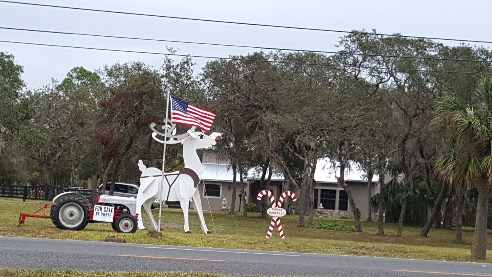
Notice the flag. We had a nice tailwind for the last half of the day.


Looks like snow, but it is little white flowers.

Titusville is across the Indian River from Kennedy Space Center. It was a bit sad, on the day after John Glenn died, to be entering Space Commerce Park on Grissom Parkway. First street after we entered was John Glenn Blvd.

We are staying for a few days in our friends Jim and Nancy's home in Cocoa. They are also letting us store our bike here. We will be flying home 12/15 for Christmas and stuff. We will fly back to Florida the first week after New Year.

We have ridden our bike 83 times, for a little over 275 hours and 3,136 miles. Bike Journal says we burned 196,852 Calories doing it, but I don't feel a whole lot lighter. Our next target city is Punta Gorda, FL, where we plan to visit with friends.

Happy Holidays to all.

Thursday, December 8, 2016

Day 136, Dec. 8. Palm Coast to Edgewater, FL

If you look closely, the upright on the left says, "Do not block
vehicle lane." Oddly enough, cars are allowed on this beach. 

Traveling on the east coast of Florida, we are given an opportunity to enjoy the Atlantic at its finest. Today was, yet again, a beautiful sunny day. Google wanted to route us on and off A1A today which made very little sense to us so we ignored her. We stayed on A1A (Scenic Coastal Byway) until Daytona Beach.

As we walked along it, we could understand allowing cars. The sand is hard packed for quite a ways from the shoreline. I am not sure if it is the long shallow slope of the shore or the size of the sand grains, but, unlike most beaches, it does have a perfect surface for driving a car on.

Daytona City can be seem from anywhere on the beach.
After a leisurely walk along the shore we forced ourselves to get back on the road.

Shortly before we arrived in Edgewater, the Halifax becomes a reserve filled with
Mangrove trees. This patch is fairly young. Fully mature trees would have much
 more of the trunks visible.
Again Google wanted us to cross the Halifax River onto mainland Florida, however we were enjoying the barrier island so much we continued our course until the Dunlawton Causeway (bridge to the rest of us). Once over we followed the river as far as we could, doing our best to avoid Route One, four lane divided highway.

 We continued to enjoy the scenery all the way into Edgewater. Tomorrow we leave A1A and head to Cocoa, the home of our friends Nancy and Jim who have generously offered the use of their home to us.

Wednesday, December 7, 2016

Day 134-135, Dec. 6-7. St Augustine, FL rest day, then ride to Palm Coast, FL

We had originally booked an Airbnb for both our nights here. But the place was so filthy and musty smelling that we found a motel instead. If you come to St. Augustine, don't take an Airbnb on Davis St.

We slept in, of course, and planned our day over coffee. Task #1, take a guided trolley ride around town to orient ourselves. We find this a good way to find out more about a town without actually working at it. Plan after trolley ride: Tour historic fort, lunch in colonial area of city, tour Whetstone chocolate factory, tour St. Augustine distillery.

The Castillo de San Marcos has guarded St. Augustine since 1672. It is the tenth fort built on the site. After the preceding nine were burned down, the Spanish finally ponied up the money to make the fort out of stone. The fort was built in the form of a four pointed star.


 If your buddies in the point over there were being attacked, you could rake the attacker's lines with enfilade fire.

Web site: https://www.nps.gov/casa/index.htm


Lunch was at the Bull and Crown Public House.                      


 Touring the Whetstone Chocolate company. Don't know what the machine did, but I wanted to put my finger in the stream.


 The tour and tasting at the St. Augustine Distillery was double fun. We met a couple from Lansing, Joe and Sally, and their friend Mary. We all vowed to re-connect when we returned to GR in December. We also tasted some very nice bourbon, two rums, vodka, and two gins. One of the gins was aged in French vermouth barrels for a short while. Kind of like a martini in a bottle.


 View of two pot stills.


 Joe and Sally were kind enough to take the liquor that we bought, and take it back to MI for us. Very nice people whom we hope to see soon, and not just because they have our booze.


Today's ride was a blast. First of all, we had to take this picture:

 
 You know what we're talkin' about.

On the way out of town, we stopped at the St. Augustine Alligator Farm. http://www.alligatorfarm.com/ This was a totally cool place. If you are anywhere near it, you should go.


Entering the farm, this greeted us. It is fiberglass, but made me jump none the less.

We took too many pictures, but go to the web site if you can't go in person.

 After over two hours at the Alligator Farm, we got going on the road. We had a 4-6 mph quartering tail wind, and a pretty much dead flat road, so the miles flew by. Still on a barrier island, so the ocean is always there.


 Obviously, sometimes the ocean becomes overly friendly and pays a visit. Some folks have figured out how to prepare for that.


 Tomorrow we ride 46 miles along the shore to Edgewater, FL. Should be another fun day. We will send warm thoughts to our friends in Michigan who are about to get snow.

Tuesday, December 6, 2016

Day 133, Dec 5. Neptune Beach, FL to St Augustine, FL

We left Neptune Beach feeling foot loose and fancy free. At 9 AM it was already a sunny 70 degrees and St Augustine was a mere 35 miles away. We were in no hurry, which was a good thing since we had a hellacious head wind.

The vast majority of the time we road on Florida A1A Scenic and Historical Coastal Hwy, a straight flat road that was built on a barrier island just off mainland Florida. We had the Atlantic ocean on one side and the Guana River on the other. The views were fantastic thanks in part to Hurricane Mathew. Apparently there was supposed to be a berm on the Atlantic side of the road that prevented a good view of the water, but Mathew swept it away.

This home was "condemned" but appeared occupied.
Of course, Mathew also damaged a lot of homes. We passed many homes with orange squares and the date 10/08/16 written on them. According to a local, it was the  Army Corp of Engineers that marked homes.  The  orange square with the x through it means the house is condemned. A plain square means the home must be repaired before folks move back in and a partial square means the house may be occupied while repairs are being done. They were a lot of repair crews out, but here were also homes that had painted over the orange.


John and I obviously chose the wrong professions.


Along the way we stopped at the spot where Juan Ponce de Leon landed in Florida in 1515. It is a preserve that the plaque claims looks the same as it did when Leon arrived. This stop is nestled in the Guana Tolomato Matanzas National Estuarine Research Reserve, a 30 mile 73,352 acres reserve. There is a public beach and viewing area. It is a great spot to see the vast ocean on one side and the
reserve on the other. Quite a view.

On the left is the Guana river basin; on the right is the Atlantic Ocean. 
The beach was covered with shells
and shark teeth.


For me, walking a beach is where I find my bliss, so John and I went for a stroll. The locals say that every beach has it own unique aspects and we have found that to be largely true. This beach had an inordinate amount of shells along the shoreline. Most were tiny, no bigger than my pinky nail. It was odd walking in deep deposits of shells. This beach, we were told, was known for its shark teeth. If you wanted to collect teeth, looking along this beach was your best bet. I have to admit, it gave me pause. I had been lamenting about wanting to swim, but after that tidbit, not so much.

Eventually, we had to get back on the road. Not a hardship since the views continued to be spectacular. Next time you find yourself traveling on the east side of Florida near Jacksonville, do yourself a favor and trade US 95 for Florida A1A. Stop at a couple beaches. Take a stroll. Yes, it will take longer, but it be well worth it in the end.


Sunday, December 4, 2016

Day 132, Dec 4. Kings Bay, GA, to Neptune Beach, FL

We have made it to Florida! And only four days later than projected. This is the 16th state we have ridden in on this tour, plus Ontario, plus DC. Having said that, today promised to be an ordinary day on the bike. Would be about 50F when we started out, with about 50 miles to do. Wind would be a quartering head wind at about 12 mph, so we would be a bit slow. Margaret's detour onto Black Rock Beach changed all that for the better.


Headwind.

By the time we crossed the bridge into Florida, the temperature had risen to 72.


Yes, a new state.


 It was so warm, that we decided to bare a portion of our anatomy that had not seen the light of day for months.

 Knees.

So we cycled along, over the bridge to Amelia Island, over the bridge to Big Talbot Island and the state park there. Margaret suggested we stop for an energy bar. While sitting and eating, she noticed a sign for a path to Black Rock Beach.

The bush the path traveled through.


Imagine trying to make your way through undergrowth like this.


The path:
 

The beach at the end of the path was unworldly.

 
  Had to find our way through.


 The black rocks looked like basalt to me, but I will defer to someone more knowledgeable. I am not aware of any history of vulcanism in Florida.


I believe I found some little roots penetrating the rock, even near the surf. Maybe palms in the past?


They were about 1-2 mm in diameter, and felt woody when I tried to pull them from the rock.

We could have stayed all day, but having no tent, camping gear, water, or food, we decided to cycle on.

One of my favorite things to do while cycling is to take a ferry. It seems almost like cheating, I move over the surface of the earth, but I don't have to pedal. We took the Ft George Island to Mayport ferry today.


 Shrimp boats.
The ferry is part of the East Coast Greenway bicycle route.

 Yep, got a flat today, The rear tire had over 1,700 miles on it, and felt really thin, so we replaced it with one of the Schwalbe Marathon plus tires we were carrying.


 Tomorrow we ride 34 miles to St Augustine, and a rest day at an airBNB.

Saturday, December 3, 2016

Day 129-131, Dec 1-3. Darien, GA to Kings Bay GA

In Washington DC we almost got rid of the rack because it was
interfering with the trailer hitch. Thank heavens we didn't!
There is nothing like the sound of your trailer scrapping along the pavement to get your attention. As John mentioned in our last entry, one of the main supports on our trailer's frame broke in two places. I believe the first break was where the side rail attaches to the front rail. Then over time the side rail bent under the weight of the trailer and finally gave out. Earlier, I had wondered if the gap between the bottom and side panels had gotten larger but chalked it up to my imagination. Lesson one: if you notice any changes - investigate.

Once the trailer began scraping, we when into problem solving mode. I got the extra bungees out and John attached them from the trailer our back rack pulling the trailer high enough to get us in. It was imperfect, we had to stop twice to adjust the bungees, but it got us in. Barely.

I went on the net and found the needed part while John went down to the desk to extend out stay. The part was only $99, but shipping was going to take 6 to 10 days! I checked the cost to speed up delivery to 4 days; $185 dollars! Ridiculous. Checking Amazon, I found a brand new trailer for $299. To get next day delivery added $26. It was a no-brainer.

Unfortunately, next day air is not really the next day; it's the fastest they can get it to you. In our case, it's 3 days. Sigh. Now we had plane tickets and 6 days worth of reservations that had to be changed, which worked out after a long call to Booking.com. All part of the thrill of travel. :)

Today was a flat and, thankfully, uneventful ride. Basically turn right onto US 17 for 57 miles and turn left to arrive at the hotel. We did however stop at Captain Stan's Smokehouse. A ramshackle, kinda grungy open air bar that accepted only cash and has fabulous food. I got the Trinity Bowl, a combination of baked beans, pork shoulder, and cold slaw. I highly recommend it.

We enter Florida tomorrow. Hard to believe we've made it this far already!


Thursday, December 1, 2016

Day 126-128, Nov. 28-30. Savannah GA rest, then Savannah to Darien, GA

Savannah was fun, bigger than Charleston, and with a different, more egalitarian history. The stated goal of the founders was to make a colony that would allow anyone who wanted to work to find a job that would support him and his family. The city was founded on a natural 40 foot high bluff overlooking the Savannah River. There is a very vibrant restaurant area down by the river. Climbing down there is more...interesting than climbing back up. Fortunately, the city has helpfully provided signs that let you know the stairs that you are using at your own risk are historical.


The bars also had helpful signs.


Savannah is built around 22 park like squares. The entire historic downtown is heavily planted with live oaks and other trees and plants.


One of the squares.


Street view.

Live oaks are not oaks. They are also not deciduous, so I guess that's why they are called 'live' as their leaves don't die in the fall. Their seeds also look a lot like acorns, so I guess that is where 'oak' comes from.

Probably could have stayed longer in Savannah, but winter is approaching, or so they tell us. You would not have known that by the temperature on 11/30 when we left town.


After our experience with route 17 on the way to Savannah, I was wary of spending 51 miles on it today, but I needent have worried. About 90% of our time on 17 was enjoyable today. I think these signs helped.


Some signs do seem wrong somehow.


The ride was going really well, despite temps into the low 80's, when a minor disaster occured about six miles from our motel. The frame on our Burley trailer broke so that the front of the trailer dragged along the ground. We were able to use some spare bungies to attach it to the rear rack of the bike, and keep it off the ground for the last miles, but we barely made it in. We are staying two extra nights in Darien, GA waiting for parts.